
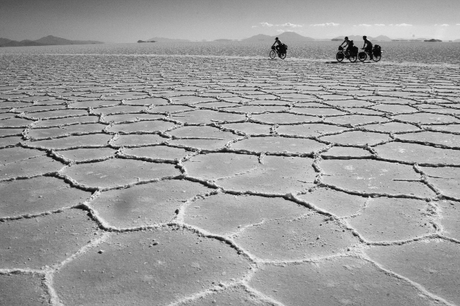
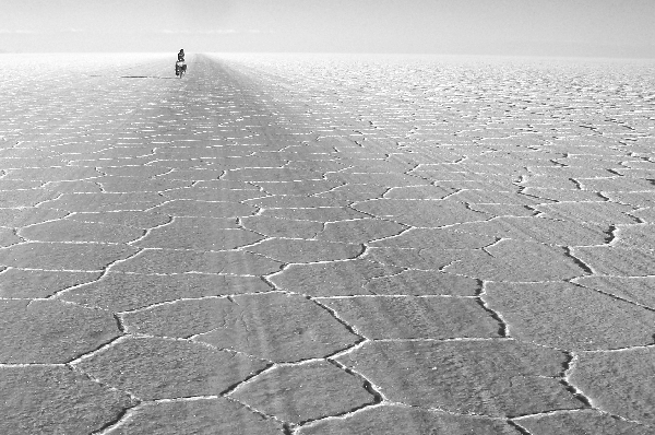
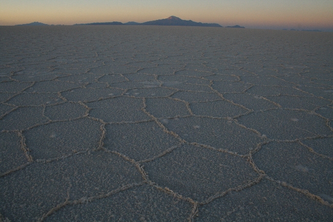
Bolivia’s Salar de Uyuni is a touring cyclist’s mecca. The Salar was once a giant prehistoric lake that dried to form the world’s largest salt desert. Riding across this immense, completely level crystalline world is an unreal, almost mystical experience. Getting there through some of Bolivia’s most remote country is a big part of the adventure. The fierce winds, washboard, sand roads, freezing nights and near total lack of supplies along the way made this one of the most challenging stages of our entire Alaska-Argentina route so far.
I’d read a few cyclists’ blogs in preparation of our approach on the Salar. There seemed to be a consensus that our planned route from Challapata to Tahua would be tough. Some bloggers seemed personally offended by the road, and cursed Bolivia, Bolivian road engineers and the salty water and llama meat they had to consume to survive in this inhospitable region. With this in mind, we loaded up on food and water and braced ourselves for a hellish ride.
The road to the Salar de Uyuni did not disappoint.
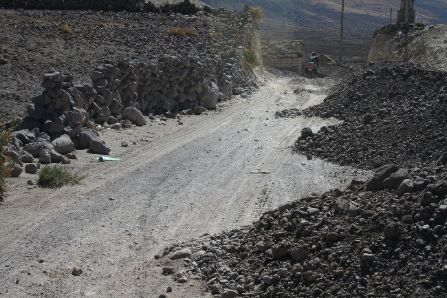
From Challapata to Quillacas, we met with unexpectedly paved roads and a surprisingly easy-to-follow route. As we headed southwest from Quillacas, however, the road began to deteriorate. Happily, alternative routes popped up along either side of the road, where jeeps had forged their own trails in favour of a smoother ride. As I cruised effortlessly along on the pancake-flat, hardened mud, swerving around bushes and shrubs, I thought, “What was everyone whining about? Buncha whiney wimps…” and so on.
My smugness and the mud flats ended at around the same time. Right when the washboard began in earnest and the alternative tracks became sand dunes.
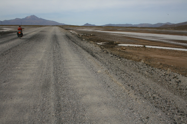
A long stretch of washboard is about the worst thing you can throw at a hundred-pound bike with no suspension and high-pressure touring tires. Either you bob along at 5 km/h and get seasick, or you push it and shake all your bolts (and fillings) loose with terrific violence.
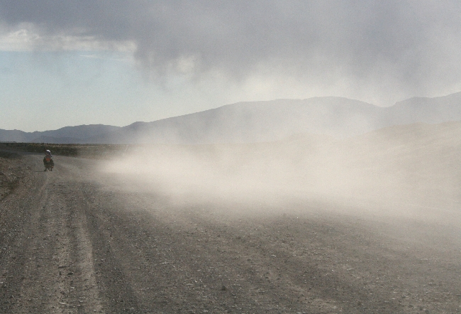
I say about the worst thing, because once you combine washboard with deep sand, those hard tires and heavy load mean some serious sweating and cursing to keep the bike upright. Add 70 km/h headwinds (which pick up around 2 PM every day between Quillacas and Tahua), and any forward motion involves tooth-grinding, tendon-tearing effort. Just before reaching Alianza, Lucie got to watch me throw a little fit as I lost my front wheel in the sand and bailed. I punched some rocks, kicked up some dunes and spat at the wind. Lucie gave me a hug for my performance. We carried on, eyes narrowed behind our sunglasses, our skin stinging from the flying sand, our tires churning and shifting as we crawled across the seemingly endless expanse of forlorn high desert.
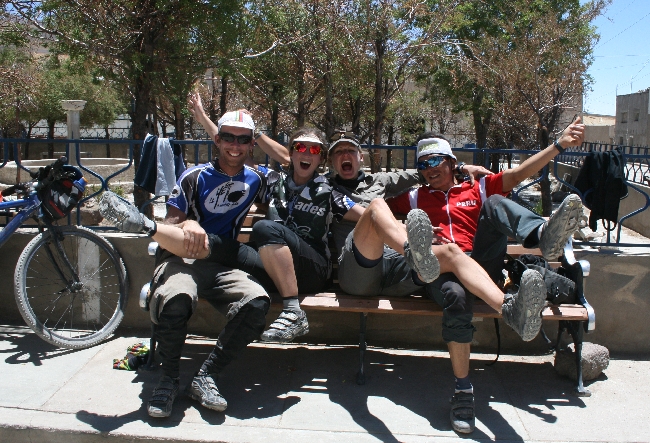
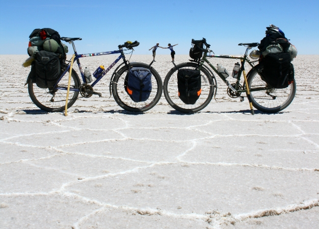
Of course, it was more than worth it. Once we had a view of the salt, we were as giddy as a couple of kids. After all that anticipation, we gleefully coasted into the heart of one of the world’s natural wonders. The ride was only made sweeter by the fact that we were accompanied by the legendary Lucho, owner of Trujillo Peru’s Casa Ciclista, and Nina, a dynamic German traveller with a great sense of humour whom we’ve met along the road more than once in the past months.
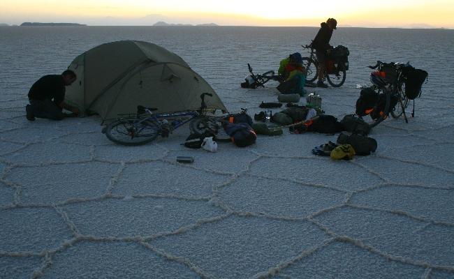
Here’s a little video of our first few pedal strokes early in the morning after camping on the salt.
Check back soon for our photo gallery!
How to Cycle Across the Salar de Uyuni: Challapata to Uyuni
For those planning to ride the Salar, here’s some info on the route we took, which accesses the Salar from the north. Keep in mind there are probably several routes (they change with every rainfall) that will lead you from Salinas to Tahua; just keep asking the trucks and jeeps you run into along the way.
KM 0: Challapata. Freshly-paved through Huari and beyond. Huari has groceries.
KM 50: Quillacas. Rougher roads begin. A store with yogurt, bread, water, pop, etc. By now your compass will have stopped working, one of the Salar’s quirky effects.
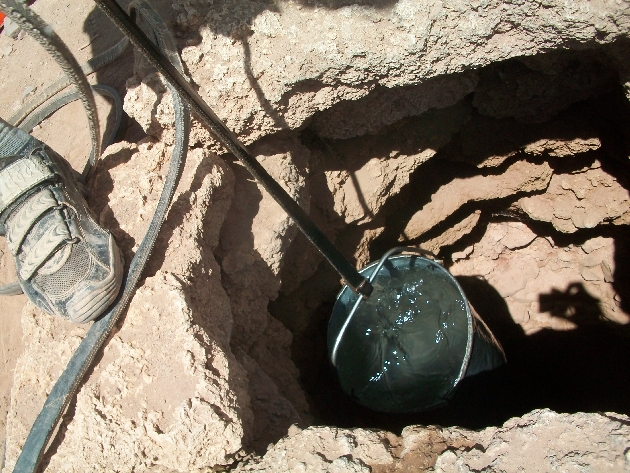
KM 92: Villa Esperanza. A tiny shop off the main square sells only crackers and soda pop. You can borrow the shopkeeper’s bucket and draw some murky, somewhat saline water from his well. Drinkable if you have a water pump. Paved section (only 3 km long as of December 2010) starts behind shop!
KM 100: Tambo Tambillo. Not much to it.
KM 109: Village with actual people in it. Maybe some juice or pop.
KM 110: Giant meteor crater on the right side of the road.
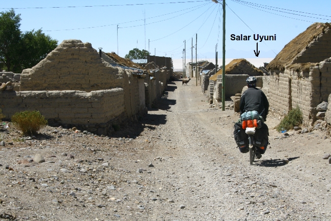
KM 147: Salinas de Mendoza. A real town that will seem like a mirage after the desolate country you’ve just ridden through. A gas station, a nice town square, lots of little shops, 2 restaurants and a hostel “downtown” (30 Bs/night is the gringo price). Make sure you fill up on extra everything before moving on. Hostal Salinas serves up a good almuerzo for 10 Bs a plate. Ask locals for the “road” to Tahua, which involves surfing over some salt-crusted mud flats. Turns into sand after a few kms.
KM 165: Teeny village. Right after the village, take the left fork, which is the smaller, less travelled road. Follow the power lines along the virtually unrideable vertical boulder track that looks like a streambed.
KM 175: Alianza. Water, store. Almost there!
KM 185: Tahua, the town on the “shore” of the Salar de Uyuni. Suprisingly well-stocked store (called Aguas Cristalinas) for last-minute supplies. No restaurants. Put on a few extra layers of sunblock or the Salar will burn you to a crisp.
KM 187: Salt!!! The main jeep track will lead you straight to Isla Incahuasi (roughly 40 km), which only becomes visible from about 25 km away due to the disappearing horizon optical effect created by the salt. Head due south! Traffic from this side of the Salar is light, and as a result the salt is a little bumpy till you get near the Island.
KM 225: Isla Incahuasi. Despite what other cyclists and your travel guides tell you, there is no longer a special “free camping” deal for cyclists on the Island. Don Alfredo, Incahuasi’s original resident, has been trumped by the Bolivian Tourism Authority, who now have an office here. Camping will run you 15 Bs per person, which includes washroom access. The Island features a fancy hotel, a fancy restaurant and a basic restaurant and a small store. You can camp on the salt (out of sight of the Bolivian Tourism officials who reside on the Island, who will try to collect their 15 Bs), but beware of strong winds and get clear of any jeep tracks. You’ll need a rock or a hammer to get those tent pegs in; better to anchor the tent with your bike(s). Cook supper well before sundown, when the winds start, and bundle up for a cold night. The path from here to Colchani is very smooth, like riding on a giant slab of marble.
KM 301: Colchani, a rundown salt mining settlement on the Salar’s eastern shore. Egg burgers can be had on the “main drag” and there are a few small shops for snacks and water.
KM 322: Uyuni. You’ve made it! The incongruously upscale main square features expensive pizza and beer, some internet cafés, banks and money changers; the market and bus terminal areas offer better deals on food and lodging. From Uyuni, you can continue south toward Tupiza (apparently a miserable road) and the Argentine border or head Northeast toward Potosi (very pretty, mostly paved).


2 responses so far ↓
1 Jeff // Dec 22, 2010 at 6:57 pm
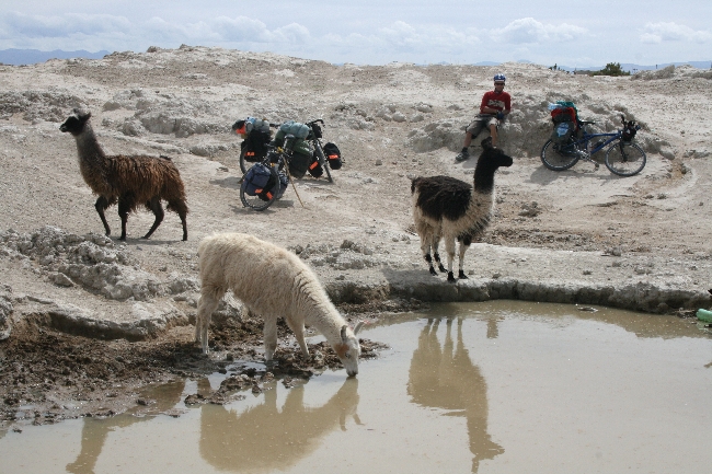
Those salt flats are surreal. Also the alpacas (right?) are hilarious. Glad to see you guys are still having a great, if rough, time of it.
2 admin // Dec 23, 2010 at 10:40 am
Hey Jeff!
They´re llamas! Alpacas are a lot smaller, usually white, have little cat ears and have 2 pairs of mittens stuffed in each cheek. Both are related to camels! Very photogenic animals. You´ll be glad to hear we´re having an easy AND great time of it at the moment, resting in elegant Sucre…
Cheers,
T
Leave a Comment